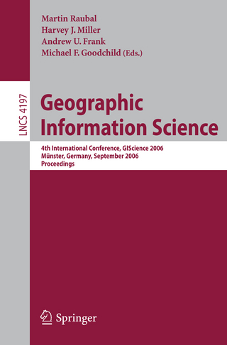
Geographic Information Science 4th International Conference, GIScience 2006, Münster, Germany, September 20-23, 2006, Proceedings - nuovo livro
2006, ISBN: 3540445269
2006 Kartoniert / Broschiert Geoinformationssystem - GIS, Informationssystem / Geoinformationssystem, Nautik, Navigation, Semantic Web, World Wide Web / Semantic Web, Geowissenschaften,… mais…
| Achtung-Buecher.de MARZIES.de Buch- und Medienhandel, 14621 Schönwalde-Glien Custos de envio:Versandkostenfrei innerhalb der BRD. (EUR 0.00) Details... |

2006, ISBN: 9783540445265
This book constitutes the refereed proceedings of the 4th International Conference on Geographic Information Science, GIScience 2006. The book presents 26 revised full papers. Among tradi… mais…
| BarnesandNoble.com new in stock. Custos de envio:zzgl. Versandkosten., mais custos de envio Details... |

2006, ISBN: 9783540445265
Livro de bolso
[ED: Kartoniert / Broschiert], [PU: Springer Berlin Heidelberg], Dieser Artikel ist ein Print on Demand Artikel und wird nach Ihrer Bestellung fuer Sie gedruckt. Proceedings of the 4th In… mais…
| booklooker.de |

2006, ISBN: 9783540445265
Livro de bolso
4th International Conference, GIScience 2006, Münster, Germany, September 20-23, 2006, Proceedings, Buch, Softcover, [PU: Springer Berlin], [ED: 1], Springer Berlin, 2006
| lehmanns.de Custos de envio:Versand in 10-14 Tagen. (EUR 0.00) Details... |

ISBN: 9783540445265
Livre, [PU: Springer, Berlin/Heidelberg]
| Rakuten.fr |

Geographic Information Science 4th International Conference, GIScience 2006, Münster, Germany, September 20-23, 2006, Proceedings - nuovo livro
2006, ISBN: 3540445269
2006 Kartoniert / Broschiert Geoinformationssystem - GIS, Informationssystem / Geoinformationssystem, Nautik, Navigation, Semantic Web, World Wide Web / Semantic Web, Geowissenschaften,… mais…

2006, ISBN: 9783540445265
This book constitutes the refereed proceedings of the 4th International Conference on Geographic Information Science, GIScience 2006. The book presents 26 revised full papers. Among tradi… mais…

2006
ISBN: 9783540445265
Livro de bolso
[ED: Kartoniert / Broschiert], [PU: Springer Berlin Heidelberg], Dieser Artikel ist ein Print on Demand Artikel und wird nach Ihrer Bestellung fuer Sie gedruckt. Proceedings of the 4th In… mais…

2006, ISBN: 9783540445265
Livro de bolso
4th International Conference, GIScience 2006, Münster, Germany, September 20-23, 2006, Proceedings, Buch, Softcover, [PU: Springer Berlin], [ED: 1], Springer Berlin, 2006
Dados bibliográficos do melhor livro correspondente
| Autor: | |
| Título: | |
| Número ISBN: |
Dados detalhados do livro - Geographic Information Science: 4th International Conference, GIScience 2006, Münster, Germany, September 20-23, 2006, Proceedings Martin Raubal Edito
EAN (ISBN-13): 9783540445265
ISBN (ISBN-10): 3540445269
Livro de bolso
Ano de publicação: 2006
Editor/Editora: Springer Berlin Heidelberg Core >1
417 Páginas
Peso: 0,661 kg
Língua: eng/Englisch
Livro na base de dados desde 2007-05-30T20:08:15-03:00 (Sao Paulo)
Página de detalhes modificada pela última vez em 2024-02-16T15:54:55-03:00 (Sao Paulo)
Número ISBN/EAN: 9783540445265
Número ISBN - Ortografia alternativa:
3-540-44526-9, 978-3-540-44526-5
Ortografia alternativa e termos de pesquisa relacionados:
Autor do livro: frank miller, frank martin, andrew martin, andrew harvey, gooch, rau michael, mill frank, andre harvey
Título do livro: nster, international geographic, geographic information science, münster, munster, germany 2006, international conference proceedings, september
Dados da editora
Autor: Martin Raubal; Harvey J. Miller; Andrew U. Frank; Michael F. Goochild
Título: Lecture Notes in Computer Science; Information Systems and Applications, incl. Internet/Web, and HCI; Geographic Information Science - 4th International Conference, GIScience 2006, Münster, Germany, September 20-23, 2006, Proceedings
Editora: Springer; Springer Berlin
422 Páginas
Ano de publicação: 2006-09-19
Berlin; Heidelberg; DE
Peso: 1,370 kg
Língua: Inglês
53,49 € (DE)
54,99 € (AT)
59,00 CHF (CH)
POD
XIV, 422 p.
BC; Database Management; Hardcover, Softcover / Informatik, EDV/Informatik; Datenbanken; Verstehen; 3D; Geoinformationssysteme; Open Source; Performance; computational geometry; geographic data; geographic information proceeding; geographic information retrival; geographic information systems; geoinformatics; geosensor networks; geospatial; ontologies; spatial data processing; spatial decision support system; Information Systems Applications (incl. Internet); Information Storage and Retrieval; Multimedia Information Systems; Earth Sciences, general; Database Management; Computer and Information Systems Applications; Information Storage and Retrieval; Multimedia Information Systems; Earth Sciences; Angewandte Informatik; Informationsrückgewinnung, Information Retrieval; Data Warehousing; Grafische und digitale Media-Anwendungen; Geowissenschaften; EA
A Social and Spatial Network Approach to the Investigation of Research Communities over the World Wide Web.- Projective Relations in a 3D Environment.- A Multi-resolution Representation for Terrain Morphology.- A Spatiotemporal Model of Strategies and Counter Strategies for Location Privacy Protection.- Incorporating Landmarks with Quality Measures in Routing Procedures.- What Is the Region Occupied by a Set of Points?.- Voronoi Hierarchies.- Characterising Meanders Qualitatively.- Landmarks in OpenLS — A Data Structure for Cognitive Ergonomic Route Directions.- Status Functions, Collective Intentionality: Matters of Trust for Geospatial Information Sharing.- Pattern Recognition in Road Networks on the Example of Circular Road Detection.- Implementing Anchoring.- Generating Raster DEM from Mass Points Via TIN Streaming.- Towards a Similarity-Based Identity Assumption Service for Historical Places.- Coupling Bayesian Networks with GIS-Based Cellular Automata for Modeling Land Use Change.- Orientation Calculi and Route Graphs: Towards Semantic Representations for Route Descriptions.- Incremental Rank Updates for Moving Query Points.- The Head-Body-Tail Intersection for Spatial Relations Between Directed Line Segments.- A GIS-Based Approach for Urban Multi-criteria Quasi Optimized Route Guidance by Considering Unspecified Site Satisfaction.- Ontological Analysis of Observations and Measurements.- Splitting the Linear Least Squares Problem for Precise Localization in Geosensor Networks.- The Spatial Dimensions of Multi-Criteria Evaluation – Case Study of a Home Buyer’s Spatial Decision Support System.- Graph-Based Navigation Strategies for Heterogeneous Spatial Data Sets.- Correlation Analysis of Discrete Motions.- Representing Topological Relationships for Moving Objects.- UMN-MapServer: A High-Performance, Interoperable, and Open Source Web Mapping and Geo-spatial Analysis System.Outros livros adicionais, que poderiam ser muito similares com este livro:
Último livro semelhante:
9783030027612 Serious Games: 4th Joint International Conference, JCSG 2018, Darmstadt, Germany, November 7-8, 2018, Proceedings (Lecture Notes in Computer Science, Band 11243) (Stefan Göbel)
- 9783030027612 Serious Games: 4th Joint International Conference, JCSG 2018, Darmstadt, Germany, November 7-8, 2018, Proceedings (Lecture Notes in Computer Science, Band 11243) (Stefan Göbel)
- 9783319115931 Geographic Information Science (Matt Duckham; Andrew U. Frank; Edzer Pebesma; Kathleen Stewart)
- 9783319115924 Geographic Information Science (Herausgegeben:Frank, Andrew U.; Duckham, Matt; Stewart, Kathleen; Pebesma, Edzer J.)
- 9781878289452 Managing IT Resources and Applications in the World Economy: Proceedings of the 8th Information Resources Management Assoc. International Conference (Management Assoc International Conferenc)
- 9780769520513 18th International Conference on Advanced Information Networking and Applications: Proceedings: Aina 2004, 29-31 March, 2004, Fukuoka, Japan (Ieee)
< Para arquivar...


