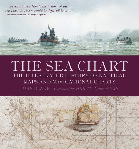
ISBN: 1591147824
Author:Blake, John. World of Books USA was founded in 2005. We want your experience with World of Books to be enjoyable and problem free. All of our paper waste is recycled within the UK … mais…
| ebay.com worldofbooksinc 98.4, Zahlungsarten: Paypal, APPLE_PAY, Google Pay, Visa, Mastercard, American Express, DISCOVER, Priority Listing. Custos de envio:Versandkostenfrei, Versand zum Fixpreis, [SHT: Economy Shipping], Montgomery Illinois, [TO: United States] (EUR 0.00) Details... |

ISBN: 9781591147824
Paperback This item shows wear from consistent use but remains in good readable condition. It may have marks on or in it, and may show other signs of previous use or shelf wear. May have … mais…
| ebay.com stvincentcharity 99.8, Zahlungsarten: Paypal, APPLE_PAY, Google Pay, Visa, Mastercard, American Express, DISCOVER. Custos de envio:Versandkostenfrei, Versand zum Fixpreis, [SHT: Economy Shipping], Oregon 974** Eugene, [TO: United States, New Zealand, Fiji, Papua New Guinea, Wallis and Futuna, Gambia, Malaysia, Taiwan, Poland, Oman, Suriname, United Arab Emirates, Kenya, Argentina, Guinea-Bissau, Armenia, Uzbekistan, Bhutan, Senegal, Togo, Ireland, Qatar, Burundi, Netherlands, Iraq, Slovakia, Slovenia, Equatorial Guinea, Thailand, Aruba, Sweden, Iceland, Macedonia, Belgium, Israel, Kuwait, Liechtenstein, Benin, Algeria, Antigua and Barbuda, Italy, Swaziland, Tanzania, Pakistan, Burkina Faso, Panama, Singapore, Kyrgyzstan, Switzerland, Djibouti, Chile, China, Mali, Botswana, Republic of Croatia, Cambodia, Indonesia, Portugal, Malta, Tajikistan, Vietnam, Cayman Islands, Paraguay, Saint Helena, Cyprus, Seychelles, Rwanda, Bangladesh, Australia, Austria, Sri Lanka, Gabon Republic, Zimbabwe, Bulgaria, Czech Republic, Norway, Côte d'Ivoire (Ivory Coast), Kiribati, Turkmenistan, Grenada, Greece, Haiti, Greenland, Yemen, (EUR 0.00) Details... |

2009, ISBN: 1591147824
[EAN: 9781591147824], Used, very good, [PU: Naval Institute Press], very good, Books
| AbeBooks.com Big Bill's Books, Austin, TX, U.S.A. [74145536] [Rating: 5 (of 5)] NOT NEW BOOK. Custos de envio: EUR 3.00 Details... |

2009, ISBN: 1591147824
[EAN: 9781591147824], New book, [PU: Naval Institute Press], new, Books
| AbeBooks.com GoldBooks, Austin, TX, U.S.A. [71454205] [Rating: 5 (of 5)] NEW BOOK. Custos de envio: EUR 4.25 Details... |

ISBN: 1591147824
The Whitewood Team. Very Good, Festpreisangebot, [LT: FixedPrice], Bestes Angebot, [LT: BestOffer]
| ebay.com |


ISBN: 1591147824
Author:Blake, John. World of Books USA was founded in 2005. We want your experience with World of Books to be enjoyable and problem free. All of our paper waste is recycled within the UK … mais…

John Blake:
The Sea Chart: The Illustrated History of Nautical Maps and Navigational Charts - Livro de bolsoISBN: 9781591147824
Paperback This item shows wear from consistent use but remains in good readable condition. It may have marks on or in it, and may show other signs of previous use or shelf wear. May have … mais…

no/na AbeBooks.com
2009
ISBN: 1591147824
[EAN: 9781591147824], Used, very good, [PU: Naval Institute Press], very good, Books

no/na AbeBooks.com
2009, ISBN: 1591147824
[EAN: 9781591147824], New book, [PU: Naval Institute Press], new, Books

ISBN: 1591147824
The Whitewood Team. Very Good, Festpreisangebot, [LT: FixedPrice], Bestes Angebot, [LT: BestOffer]
Dados bibliográficos do melhor livro correspondente
| Autor: | |
| Título: | |
| Número ISBN: |
Dados detalhados do livro - The Sea Chart: The Illustrated History of Nautical Maps and Navigational Charts
EAN (ISBN-13): 9781591147824
ISBN (ISBN-10): 1591147824
Livro de bolso
Ano de publicação: 2009
Editor/Editora: U S NAVAL INST PR
160 Páginas
Peso: 0,937 kg
Língua: eng/Englisch
Livro na base de dados desde 2009-08-05T09:33:26-03:00 (Sao Paulo)
Página de detalhes modificada pela última vez em 2023-06-01T21:36:40-03:00 (Sao Paulo)
Número ISBN/EAN: 1591147824
Número ISBN - Ortografia alternativa:
1-59114-782-4, 978-1-59114-782-4
Ortografia alternativa e termos de pesquisa relacionados:
Autor do livro: john blake, duke
Título do livro: history navigation, illustrated history art, all sea navigational, maps, chart charts
Outros livros adicionais, que poderiam ser muito similares com este livro:
Último livro semelhante:
8601406060210 The Sea Chart: The Illustrated History of Nautical Maps and Navigational Charts (Blake, John)
< Para arquivar...

