menor preço: € 36.84, preço mais alto: € 41.90, preço médio: € 39.64
(*)
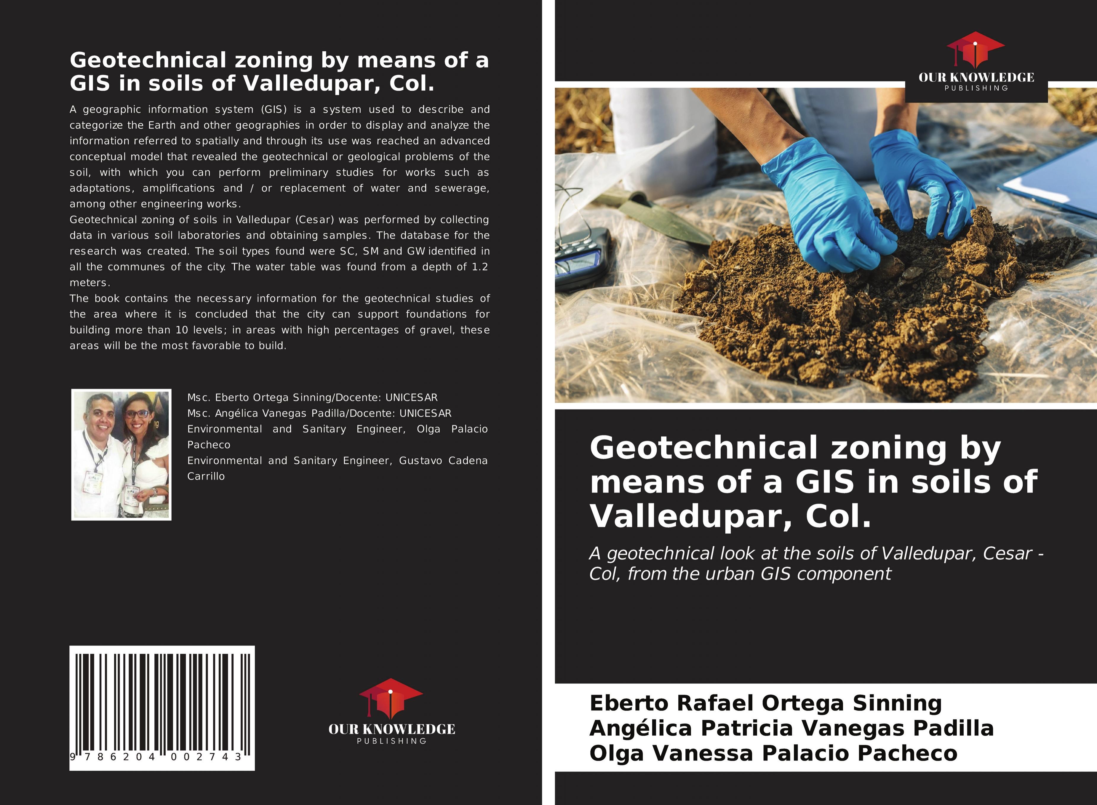
Eberto Rafael Ortega Sinning: Geotechnical zoning by means of a GIS in soils of Valledupar, Col. : A geotechnical look at the soils of Valledupar, Cesar - Col, from the urban GIS component - Livro de bolso
[EAN: 9786204002743], Neubuch, [PU: Our Knowledge Publishing], nach der Bestellung gedruckt Neuware - A geographic information system (GIS) is a system used to describe and categorize the… mais…
[EAN: 9786204002743], Neubuch, [PU: Our Knowledge Publishing], nach der Bestellung gedruckt Neuware - A geographic information system (GIS) is a system used to describe and categorize the Earth and other geographies in order to display and analyze the information referred to spatially and through its use was reached an advanced conceptual model that revealed the geotechnical or geological problems of the soil, with which you can perform preliminary studies for works such as adaptations, amplifications and / or replacement of water and sewerage, among other engineering works.Geotechnical zoning of soils in Valledupar (Cesar) was performed by collecting data in various soil laboratories and obtaining samples. The database for the research was created. The soil types found were SC, SM and GW identified in all the communes of the city. The water table was found from a depth of 1.2 meters.The book contains the necessary information for the geotechnical studies of the area where it is concluded that the city can support foundations for building more than 10 levels; in areas with high percentages of gravel, these areas will be the most favorable to build. 56 pp. Englisch, Books<
AbeBooks.de
AHA-BUCH GmbH, Einbeck, Germany [51283250] [Rating: 5 (von 5)] NEW BOOK. Custos de envio:Versandkostenfrei. (EUR 0.00) Details...
(*) Livro esgotado significa que o livro não está disponível em qualquer uma das plataformas associadas buscamos.
Paperback, [PU: Our Knowledge Publishing], A geographic information system (GIS) is a system used to describe and categorize the Earth and other geographies in order to display and analyz… mais…
Paperback, [PU: Our Knowledge Publishing], A geographic information system (GIS) is a system used to describe and categorize the Earth and other geographies in order to display and analyze the information referred to spatially and through its use was reached an advanced conceptual model that revealed the geotechnical or geological problems of the soil, with which you can perform preliminary studies for works such as adaptations, amplifications and / or replacement of water and sewerage, among other engineering works.Geotechnical zoning of soils in Valledupar (Cesar) was performed by collecting data in various soil laboratories and obtaining samples. The database for the research was created. The soil types found were SC, SM and GW identified in all the communes of the city. The water table was found from a depth of 1.2 meters.The book contains the necessary information for the geotechnical studies of the area where it is concluded that the city can support foundations for building more than 10 levels; in areas with high percentages of gravel, these areas will be the most favorable to build., Environmental Science, Engineering & Technology<
BookDepository.com
Custos de envio:Versandkostenfrei. (EUR 0.00) Details...
(*) Livro esgotado significa que o livro não está disponível em qualquer uma das plataformas associadas buscamos.
[EAN: 9786204002743], Neubuch, [PU: Our Knowledge Publishing], TECHNIK BAUTECHNIK UMWELTTECHNIK, Dieser Artikel ist ein Print on Demand Artikel und wird nach Ihrer Bestellung fuer Sie ged… mais…
[EAN: 9786204002743], Neubuch, [PU: Our Knowledge Publishing], TECHNIK BAUTECHNIK UMWELTTECHNIK, Dieser Artikel ist ein Print on Demand Artikel und wird nach Ihrer Bestellung fuer Sie gedruckt., Books<
AbeBooks.de
moluna, Greven, Germany [73551232] [Rating: 5 (von 5)] NEW BOOK. Custos de envio:Versandkostenfrei. (EUR 0.00) Details...
(*) Livro esgotado significa que o livro não está disponível em qualquer uma das plataformas associadas buscamos.
Ortega Sinning, Eberto Rafael; Vanegas Padilla, Angélica Patricia; Palacio Pacheco, Olga Vanessa: Geotechnical zoning by means of a GIS in soils of Valledupar, Col. A geotechnical look at the soils of Valledupar, Cesar - Col, from the urban GIS component - nuovo livro
Geotechnical zoning by means of a GIS in soils of Valledupar, Col. : A geotechnical look at the soils of Valledupar, Cesar - Col, from the urban GIS component - Livro de bolso
[EAN: 9786204002743], Neubuch, [PU: Our Knowledge Publishing], nach der Bestellung gedruckt Neuware - A geographic information system (GIS) is a system used to describe and categorize the… mais…
[EAN: 9786204002743], Neubuch, [PU: Our Knowledge Publishing], nach der Bestellung gedruckt Neuware - A geographic information system (GIS) is a system used to describe and categorize the Earth and other geographies in order to display and analyze the information referred to spatially and through its use was reached an advanced conceptual model that revealed the geotechnical or geological problems of the soil, with which you can perform preliminary studies for works such as adaptations, amplifications and / or replacement of water and sewerage, among other engineering works.Geotechnical zoning of soils in Valledupar (Cesar) was performed by collecting data in various soil laboratories and obtaining samples. The database for the research was created. The soil types found were SC, SM and GW identified in all the communes of the city. The water table was found from a depth of 1.2 meters.The book contains the necessary information for the geotechnical studies of the area where it is concluded that the city can support foundations for building more than 10 levels; in areas with high percentages of gravel, these areas will be the most favorable to build. 56 pp. Englisch, Books<
NEW BOOK. Custos de envio:Versandkostenfrei. (EUR 0.00) AHA-BUCH GmbH, Einbeck, Germany [51283250] [Rating: 5 (von 5)]
Paperback, [PU: Our Knowledge Publishing], A geographic information system (GIS) is a system used to describe and categorize the Earth and other geographies in order to display and analyz… mais…
Paperback, [PU: Our Knowledge Publishing], A geographic information system (GIS) is a system used to describe and categorize the Earth and other geographies in order to display and analyze the information referred to spatially and through its use was reached an advanced conceptual model that revealed the geotechnical or geological problems of the soil, with which you can perform preliminary studies for works such as adaptations, amplifications and / or replacement of water and sewerage, among other engineering works.Geotechnical zoning of soils in Valledupar (Cesar) was performed by collecting data in various soil laboratories and obtaining samples. The database for the research was created. The soil types found were SC, SM and GW identified in all the communes of the city. The water table was found from a depth of 1.2 meters.The book contains the necessary information for the geotechnical studies of the area where it is concluded that the city can support foundations for building more than 10 levels; in areas with high percentages of gravel, these areas will be the most favorable to build., Environmental Science, Engineering & Technology<
[EAN: 9786204002743], Neubuch, [PU: Our Knowledge Publishing], TECHNIK BAUTECHNIK UMWELTTECHNIK, Dieser Artikel ist ein Print on Demand Artikel und wird nach Ihrer Bestellung fuer Sie ged… mais…
[EAN: 9786204002743], Neubuch, [PU: Our Knowledge Publishing], TECHNIK BAUTECHNIK UMWELTTECHNIK, Dieser Artikel ist ein Print on Demand Artikel und wird nach Ihrer Bestellung fuer Sie gedruckt., Books<
NEW BOOK. Custos de envio:Versandkostenfrei. (EUR 0.00) moluna, Greven, Germany [73551232] [Rating: 5 (von 5)]
Ortega Sinning, Eberto Rafael; Vanegas Padilla, Angélica Patricia; Palacio Pacheco, Olga Vanessa: Geotechnical zoning by means of a GIS in soils of Valledupar, Col. A geotechnical look at the soils of Valledupar, Cesar - Col, from the urban GIS component - nuovo livro
1Como algumas plataformas não transmitem condições de envio e estas podem depender do país de entrega, do preço de compra, do peso e tamanho do item, de uma possível adesão à plataforma, de uma entrega direta pela plataforma ou através de um fornecedor terceirizado (Marketplace), etc., é possível que os custos de envio indicados pela terralivro não correspondam aos da plataforma ofertante.
Dados bibliográficos do melhor livro correspondente
Dados detalhados do livro - Geotechnical zoning by means of a GIS in soils of Valledupar, Col. A geotechnical look at the soils of Valledupar, Cesar - Col, from the urban GIS component
EAN (ISBN-13): 9786204002743 ISBN (ISBN-10): 6204002740 Livro de bolso Ano de publicação: 2021 Editor/Editora: Our Knowledge Publishing
Livro na base de dados desde 2021-12-17T11:55:26-03:00 (Sao Paulo) Página de detalhes modificada pela última vez em 2022-01-30T19:29:31-03:00 (Sao Paulo) Número ISBN/EAN: 6204002740
Número ISBN - Ortografia alternativa: 620-4-00274-0, 978-620-4-00274-3 Ortografia alternativa e termos de pesquisa relacionados: Autor do livro: palacio, sinning